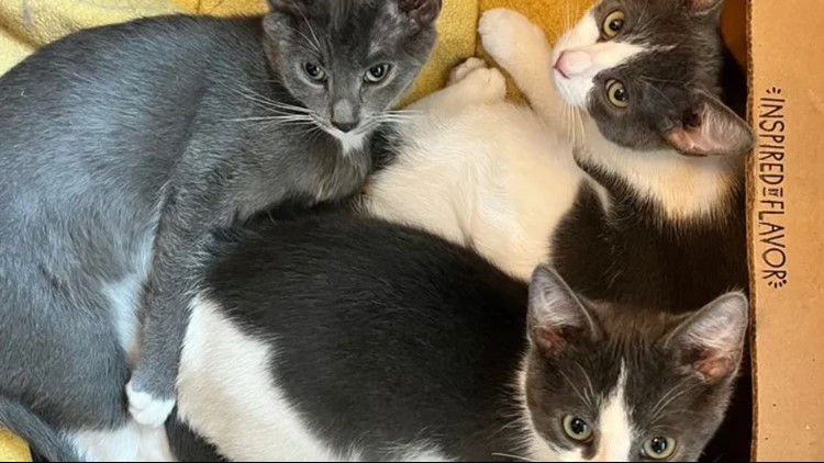
a Better Bubble™

Aggregator

Stray Dog Theatre's Godspell Hits a New Chord

2 years 1 month ago
The pop-rock musical Godspell, conceived by John-Michael Tebelak with music and new lyrics by Stephen Schwartz, brought the words of the Bible and several of Jesus’ key parables to modern audiences by giving them a more contemporary feel. Director Justin Been contemporised the original by compressing the musical’s timeline to a single day and place — September 11, 2001 in New York City.
Tina Farmer

How Social Media Apps Could Be Fueling Homicides Among Young Americans

2 years 1 month ago

ProPublica is a nonprofit newsroom that investigates abuses of power. Sign up to receive our biggest stories as soon as they’re published.

This story is exempt from our Creative Commons license until Dec. 2, 2023.

One fall evening in 2020, Jarell Jackson and Shahjahan McCaskill were chatting in Jackson’s Hyundai Sonata, still on a post­-vacation high, when 24 bullets ripped through the car. The two men, both 26, had been close friends since preschool. They’d just returned to West Philadelphia after a few days hang gliding, zip lining and hiking in Puerto Rico. Jackson was parked outside his mom’s house when a black SUV pulled up and the people inside started shooting. Both he and McCaskill were pronounced dead at the hospital.

In the aftermath, McCaskill’s mother, Najila Zainab Ali McCaskill, couldn’t fathom why anyone would want to kill her son and his friend. Both had beaten the odds for young Black men in their neighborhood and graduated from college. Jackson had been a mental health technician in an adolescent psych ward while her son had run a small cleaning business and tended bar. She wondered if they’d been targeted by a disgruntled former employee of the cleaning business. But then the police explained: Her son and his friend had been killed because of a clash on social media among some teenagers they’d never even met.

Shahjahan McCaskill, left, and Jarell Jackson were close friends since preschool. (Courtesy of Monique Jackson)

For months, a battle had been raging on Instagram between crews based on either side of Market Street. Theirs was a long-running rivalry, but a barrage of online taunts and threats had raised tensions in the neighborhood. Police had assigned an officer to monitor the social media activity of various crews in the city, and the department suspected that the Northsiders in the SUV had mistaken one of the two friends for a rival Southsider and opened fire. An hour after the shooting, a Northsider posted a photo on Instagram with a caption that appeared to mock the victims and encourage the rival crew to collect their bodies: “AHH HAAAA Pussy Pick Em Up!!”

Jackson and McCaskill died in the first year of a nationwide resurgence in violence that has erased more than two decades of gains in public safety. In 2020, homicides spiked by 30% and fluctuated around that level for the next two years. There are early signs that the 2023 rate could show a decrease of more than 10% from last year, but that would still leave it well above pre-pandemic levels.

Najila Zainab Ali McCaskill in front of a portrait of her son Shahjahan (Hannah Price, special to ProPublica)

Criminologists point to a confluence of factors, including the social disruptions caused by COVID‑19, the rise in gun sales early in the pandemic and the uproar following the murder of George Floyd, which, in many cities, led to diminished police activity and further erosion of trust in the police. But in my reporting on the surge, I kept hearing about another accelerant: social media.

Violence prevention workers described feuds that started on Instagram, Snapchat and other platforms and erupted into real life with terrifying speed. “When I was young and I would get into an argument with somebody at school, the only people who knew about it were me and the people at school,” said James Timpson, a violence prevention worker in Baltimore. “Not right now. Five hundred people know about it before you even leave school. And then you got this big war going on.”

Never miss the most important reporting from ProPublica’s newsroom. Subscribe to the Big Story newsletter.

Smartphones and social platforms existed long before the homicide spike; they are obviously not its singular cause. But considering the recent past, it’s not hard to see why social media might be a newly potent driver of violence. When the pandemic led officials to close civic hubs such as schools, libraries and rec centers for more than a year, people — especially young people — ­were pushed even further into virtual space. Much has been said about the possible links between heavy social media use and mental health problems and suicide among teenagers. Now Timpson and other violence prevention workers are carrying that concern to the logical next step. If social media plays a role in the rising tendency of young people to harm themselves, could it also be playing a role when they harm others?

The current spike in violence isn’t a return to ’90s-era murder rates — ­it’s something else entirely. In many cities, the violence has been especially concentrated among the young. The nationwide homicide rate for 15- to 19-year-olds increased by an astonishing 91% from 2014 to 2021. Last year in Washington, D.C., 105 people under 18 were shot —nearly twice as many as in the previous year. In Philadelphia in the first nine months of 2022, the tally of youth shooting victims — 181 ­­­— equaled the tally for all of 2015 and 2016 combined. And in Baltimore, more than 60 children ages 13 to 18 were shot in the first half of this year. That’s double the totals for the first half of each year from 2015 to 2021 — and it has occurred while overall homicides in the city declined. Nationwide, this trend has been racially disproportionate to an extreme degree: In 2021, Black people ages 10 to 24 were almost 14 times more likely to be the victims of a homicide than young white people.

Those confronting this scourge — ­police, prosecutors, intervention workers — ­are adamant that social media instigation helps explain why today’s young people are making up a larger share of the victims. But they’re at a loss as to how to combat this phenomenon. They understand that this new wave of killing demands new solutions — ­but what are they?

To the extent that online incitement has drawn attention, it’s been focused on rap videos, particularly those featuring drill music, which started in Chicago in the early 2010s and is dominated by explicit baiting of “opps,” or rivals. These videos have been linked to numerous shootings. Often, though, conflict is sparked by more mundane online activity. Teens bait rivals in Instagram posts or are goaded by allies in private chats. On Instagram and Facebook, they livestream incursions into enemy territory and are met by challenges to “drop a pin” — ­to reveal their location or be deemed a coward. They brandish guns in Snapchat photos or YouTube and TikTok videos, which might provoke an opp to respond — ­and pressure the person with the gun to actually use it.

In December, I met 21-year-old Brandon Olivieri at the state prison in Houtzdale, Pennsylvania, where he is serving time for murder. In 2017, Olivieri said, he had a run-in with other teens in South Philadelphia after he tried to sell marijuana on their turf. Later, in a private Instagram chat for Olivieri and his friends, someone posted a picture of a silver .45-caliber pistol. Then another member, Nicholas Torelli, posted a picture of cat feces on the sidewalk, with the caption “Brandon took a shit on opp territory.” It was a joke, but the conversation quickly turned aggressive. Later that day, Olivieri asked Torelli to drop an image of their opponents into the chat, so everyone could see what they looked like. Torelli complied, and, according to court records, Olivieri replied that he would “pop all of them.”

When Olivieri, Torelli and two friends encountered four of their opponents later that month, there were heated words, a struggle and three gunshots from the silver pistol. One bullet struck Caleer Miller, a member of Olivieri’s group. Another hit Salvatore DiNubile, in the other crew. Both died; they were 16. Olivieri was convicted of first-degree murder in DiNubile’s death and third-degree murder in Miller’s. (Torelli testified against Olivieri and was not charged.) Olivieri was sentenced to 37 years to life.

DiNubile’s father, also named Salvatore, believes the ability to share threats online encouraged Olivieri and his friends to make them; having made them, they felt compelled to follow through. “You said you were gonna do this guy. Here’s your chance,” he told me. “You try to live up to this gangster mentality that he’s self-created.” Olivieri maintains his innocence and says that he wasn’t the one who fired the fatal shots, but he agreed that he and his friends often hyped one another up by making boasts online. “It’s what we call pump-faking,” he explained.

Last year, as the number of juvenile shooting victims in Washington, D.C., climbed toward triple digits, the city’s Peace Academy, which trains community members in violence prevention, held a Zoom session dedicated to social media. Ameen Beale of the D.C. Attorney General’s Office shared his screen to display a sequence typical of online flare-ups culminating in a fatality.

The presentation started with a photo, posted to In­stagram in 2019, showing the local rapper AhkDaClicka on the Metro; the caption mocked him for being caught there, without a gun, by adver­saries. Then came a screenshot of private messages between AhkDaClicka and a rival rapper named Walkdown Will that the latter posted derisively on Instagram Live. Next, an Instagram Story from AhkDaClicka insulting another rapper who had allegedly been present at the Metro run-in and a YouTube video of AhkDaClicka rapping about the incident, including the line, “Just give me a Glock and point me to the opps.” Soon afterward, in January 2020, AhkDaClicka was fatally shot. He was 18; his real name was Malick Cisse. That May, police arrested Walkdown Will — ­William Whitaker, also 18. He pleaded guilty to second-degree murder last October.

Beale’s presentation left some participants dumbfounded. “I cannot believe the level of immaturity and stupidity that’s become the norm,” one wrote in the chat. Another asked the question looming over the session: Had anyone in the city’s violence prevention realm asked the social media companies to limit inflammatory content?

“I don’t think we’ve made much progress,” Beale admitted. When the city had sought to have posts removed, he said, the companies had rebuffed its pleas with vague arguments about free speech. Even if social media platforms did remove a post, 20 people could already have shared it with hundreds or thousands more. And given the pace of online life, you might spend five years trying to block harmful content on one platform, only for all the activity to migrate to another.

I asked a spokesperson for Google, which owns YouTube, about the AhkDaClicka video with the line about the Glock, as well as another video posted last summer, titled “Pull Da Plug.”

It showed a Louisville, Kentucky, rapper and about a dozen other young men apparently celebrating a shooting that had left a man on life support (he later died). The head of the Louisville violence ­prevention agency had told me that the victim’s family asked Google to remove the video, but it stayed up, collecting more than 15,000 views. The spokesperson, Jack Malon, told me the company generally had a “pretty high threshold” for removing music videos, in part because company policy allows exceptions for artistic content.

My conversations with Malon and his counterparts at Snap and Meta (which owns Facebook and Instagram) left me with the impression that social media platforms have given relatively little thought to their role in fueling routine gun violence, compared with the higher-profile debate over censoring incendiary political speech. Meta pointed me to its “community standards,” which are full of gray-area statements such as “We also try to consider the language and context in order to distinguish casual statements from content that constitutes a credible threat to public or personal safety.” Snap argued that its platform was more benign than others, because posts are designed to disappear and are viewed primarily by one’s friends. I also reached out to TikTok, but the company didn’t respond.

Communities, meanwhile, have been left to fend for themselves. But violence ­prevention groups are dominated by middle-­aged men who grew up in the pre-­smartphone era; they’re more comfortable intervening in person than deciphering threats on TikTok. Before the pandemic, an intern at Pittsburgh’s main anti-­violence organization scanned social media posts by young people considered at risk of becoming involved in conflicts. The Rev. Cornell Jones, the city government’s liaison to violence prevention groups, told me that the intern had once detected a feud brewing online among teenagers, some of whom had acquired firearms. Jones brought in the participants and their mothers and defused the situation. Then the intern left town for law school and the organization reverted to the ad hoc methods that are more typical for such groups. “If you’re not monitoring social media, you’re wondering why 1,000 people are suddenly downtown fighting,” Jones said ruefully. In early July, a shooting at a block party in Baltimore validated his concern: Though the event had been discussed widely on social media, no police officers were on hand; later, a video circulated of a teenager showing off what appeared to be a gun at the party. The shooting left two dead and 28 others wounded.

A decade ago, Desmond Upton Patton, a professor of social policy, communications and psychiatry at the University of Pennsylvania, got the first of several grants to study what he called “internet banging.” His research team co-designed algorithms with a team at Columbia University to analyze language, images and even emoji on Twitter and identify users at risk of harming themselves or others. The algorithms showed promise in identifying escalating online disputes. But he never allowed their use, worried about their resemblance to police surveillance efforts that had enabled profiling more than prevention. “Perhaps there is a smarter person who can figure out how to do it ethically,” he said to me.

For now, the system is failing to anticipate violence — and even, quite often, to convict people whose social media feeds incriminate them. In May, three teens were tried for the murders of Jarell Jackson and Shahjahan McCaskill in Philadelphia. At the time of the shooting, two were 17 and the third was 16. Social media activity formed a key part of the prosecutors’ evidence: Instagram posts and video feeds showed the three defendants driving around in a black SUV seemingly identical to the one that had pulled up alongside Jackson’s car. Other posts showed two of them holding a gun that matched the description of one used in the shooting. After a day of deliberations, the jury acquitted them of murder, finding two of the defendants guilty only of weapons charges. The verdict left the victims’ families reeling. “For me and my family, [the trial] was like a seven-day funeral,” Monique Jackson, Jarell’s mother, told me. Afterward, the detective who had investigated the murders speculated to her that jurors on such cases often struggle to grasp the basic mechanics of social media and how essential it is to the interactions of young people. As Patton put it to me: “What we under­estimate time and time again is that social media isn’t virtual versus real life. This is life.”

First image: Monique Jackson. Second image: Jackson holding a photo of her son Jarell. (Hannah Yoon, special to ProPublica)

Update, Aug. 9, 2023: This article has been updated to clarify YouTube’s policy for removing music videos.

by Alec MacGillis

Loss of benefits brings Missouri college food insecurity to the forefront

2 years 1 month ago

When University of Missouri student Puna Neumeier finishes a day of classes, she can’t think about homework. Her pressing worries are getting food, paying rent and taking care of her mother, who is disabled. “As a caretaker and daughter, I have to be in charge of getting the food, cooking the food, serving the food, […]

The post Loss of benefits brings Missouri college food insecurity to the forefront appeared first on Missouri Independent.

Kristina Abovyan

$1.55 billion Mega Millions jackpot is the 3rd largest in US history

2 years 1 month ago
Lottery players will have another shot Tuesday night at a massive Mega Millions prize that ranks as the third-largest jackpot in U.S. history. The estimated $1.55 billion prize has been gradually building for months thanks to 31 straight drawings without a jackpot winner. The last time someone won the game’s top prize was April 18. [...]
The Associated Press

Biden’s New Hampshire Blunder

2 years 1 month ago
Thanks to an ill-considered move by Joe Biden and the DNC, several fringe Democrats will be on the ballot in the nation’s first primary, and the president will be on the sidelines.
Robert Kuttner

The (Random) Forests for the Trees: How Our Spillover Model Works

2 years 1 month ago

ProPublica is a nonprofit newsroom that investigates abuses of power. Sign up to receive our biggest stories as soon as they’re published.

[For more technical details, view this story on our website.]

This year at ProPublica, we’ve paired computer modeling with traditional reporting to explore questions around viral outbreaks: What causes them and what can be done to prevent the next big one?

One of the most feared diseases is Ebola, which kills about half the people it infects and has shown that it can pop up in unexpected countries such as Guinea. The virus jumped from a wild animal to a human there in 2013, leading to an epidemic that ultimately left 11,000 dead around the globe.

Researchers studying how outbreaks begin have learned that deforestation can increase the chances for pathogens to leap from wildlife to humans. Jesús Olivero, a professor in the department of animal biology at the University of Malaga, Spain, found that seven Ebola outbreaks, including the one that started in Meliandou, Guinea, were significantly linked to forest loss. We found that, around five of those outbreak locations, forests had been cleared in a telltale pattern, increasing the chances that humans could share space with animals that might harbor the disease.

We wondered: Could we use what we learned about these locations to find places that had not yet experienced outbreaks but could be at risk for one? Were there places where Ebola could emerge that look a lot like Meliandou did in 2013?

With the help of epidemiologists and forest-loss experts, along with one of ProPublica’s data science advisers, Heather Lynch, professor of ecology and evolution at Stony Brook University, we developed a machine-learning model designed to detect locations that bore striking similarity to places that had experienced outbreaks.

The result? Out of a random sample of nearly 1,000 locations across 17 countries, ProPublica’s model identified 51 areas that, in 2021 (the most recent year that satellite image data on forest loss was available at the time of our analysis), looked a lot like places that had experienced outbreaks driven by forest changes.

These locations fell within forested zones in Africa that have wildlife believed to be carrying Ebola; that had recently experienced extensive forest fragmentation (that is, clearing of forests in many small, disconnected patches); and that have a population baseline that could sustain an outbreak if one emerged. To our surprise, 27 of the locations were in Nigeria, where an Ebola outbreak has never started.

After reviewing our findings, one of the researchers we consulted, Christina Faust, a research fellow at the University of Glasgow, Scotland, called the analysis a “best estimate of risk,” in light of the many outstanding questions about how Ebola arises.

“You’ve clearly identified ecological features that are consistent across the spillover locations,” Faust said. “And these ecological conditions and human conditions are cropping up in other places. And given that we don’t know so much about the reservoirs, I think this is our kind of best ability to do a risk analysis.”

Why Random Forests

This model was developed out of an earlier analysis we published in February. We used satellite imagery and epidemiological modeling to show that villages where five previous Ebola outbreaks occurred are at a greater risk of spillover happening today, including Meliandou, Guinea, the site of the worst Ebola outbreak in history.

In five locations where outbreaks had occurred, we found a distinctive pattern in how forests erode over time. At the highest level of fragmentation, the areas where humans and virus-carrying animals might interact, or “mixing zones,” are largest, and risk is at its peak. But after the forest becomes so eroded by human activity that it can’t sustain wildlife anymore, risk decreases.

That analysis focused on the research led by Olivero and an epidemiological model created by Faust and her colleagues that tracked how spillover risk changes as forests become increasingly fragmented. But there was also other intriguing research on the link between land use and Ebola spillover that caught our attention.

One paper, by a team led by Maria Rulli at the Politecnico di Milano, Italy, found a relationship between increased forest fragmentation over time and Ebola outbreaks. We came across a couple other papers that mapped out where Ebola is likely to exist in wild animals, including one by Olivero himself.

As part of the first project, we created a data set of ecological characteristics from satellite imagery. We were curious if some of the factors, like the number of forest patches or proportion of mixing zones around those patches, could shed additional light on how susceptible a location could be to disease spillover.

Months in, we asked ourselves, could we combine the 23 environmental and population characteristics and what we learned from work by Olivero, Faust and Rulli into a single model? Could such a model reveal new insights into the conditions related to forest change that make it possible for Ebola to jump from animals to humans?

On the advice of Lynch, our science adviser, we started by looking for any clear patterns or clusters among the characteristics.

But after squinting at lots of tiny scatter plots, nothing jumped out. This wasn’t entirely unexpected, because we had only seven outbreaks to compare. When the number of characteristics far outnumbers the events you’re interested in, it can be hard to tease out clear relationships. So Lynch suggested something straight from her own research playbook: decision trees and random forests.

Decision trees, Lynch explained, are machine learning algorithms that create chains of binary decisions to help distinguish groups from one another. We hoped they could help us find places that looked a lot like locations where Ebola outbreaks had occurred. These trees — not to be confused with the leafy trees in our forest data — are useful because they can sort and cluster data based on combinations of characteristics that might not be obvious when considering each individually, and flag potential matches.

Decision trees helped us figure out which population and forest characteristics best explain the differences between locations we’re interested in, and all others.

Here’s an example of one decision tree generated by our model.

Most importantly, they’re easy to understand. Unlike many machine learning models, it’s easy to pop the hood on a decision tree and examine the choices made at each step. But easy doesn’t mean unsophisticated. Many decision trees, each with random, slight differences, can be combined into something called a random forest, which aggregates the results of multiple decision trees. Random forests are a popular and versatile technique that has been used widely in academia and journalism.

Computers can generate many decision trees, each with slight differences. Together, they make up a random forest.

Any single location that is flagged by a majority of trees in a random forest is considered a location of interest.

We created a random forest made up of 1,000 trees. If a location was flagged by the random forest, then it was classified as similar to locations where Ebola outbreaks had been linked to forest loss, and reviewed by us.

Choosing Data

Our ultimate goal was a model that could figure out which characteristics were distinctive in places that had experienced Ebola outbreaks. So we created three buckets of data: outbreaks linked to forest loss, outbreaks that had other origins and random places where outbreaks never happened.

Collecting the first two buckets was easy: the seven Ebola outbreaks previously linked to forest loss by Olivero and his collaborators went into one. The rest of the outbreaks since 2000 (the earliest year for which forest loss data from Hansen/Global Forest Watch is available) went into the other.

For the third bucket, we had lots of options. We started with a database of villages and hamlets in 28 countries. Then, we found which of them overlapped with Olivero’s data that maps where conditions are favorable for wild animals to harbor Ebola. In all, we had 11 million locations to examine.

It was unfeasible to query all 11 million, so we collected a random sample of 50,000 and collected population statistics for each. We then determined which of the 50,000 locations were at least 100 kilometers, about 62 miles, away from the outbreaks already in our two buckets. Finally, we narrowed the sample to villages and hamlets where the human population was within the range of populations in our outbreak buckets, because they might interact with the forest in similar ways; for example, for firewood or hunting. The populations couldn’t be too small, either — spillover events require, by definition, human hosts to jump into.

Our last step was to filter for locations similar to those in our second bucket. In other words, these locations had characteristics that could sustain an Ebola outbreak, maybe even due to a spillover event, but for reasons unrelated to forest loss. We selected 21 of those random locations for our third bucket of data.

For all 35 locations, which we refer to as our training data, we calculated 23 different characteristics about forest change and population using a variety of data sources.

Seven locations used as training data were outbreaks tied to forest loss.

The other locations fell into two buckets: outbreaks not tied to forest loss, or locations where outbreaks were never recorded.

Training and Validating the Model

With training data in hand, we set about trying to get the model to find insightful patterns. It’s a real possibility, especially when the input data is limited, that machine learning models will find patterns where there actually are none. This is called overfitting; think of it as a computer interpreting polka dots as a connect-the-dots game.

To avoid overfitting, we trained multiple random forest models, each time withholding some of the data. This is a common strategy in ecology, where data can be scarce and it’s important to make sure that a model is not overly influenced by the idiosyncrasies of any one data point. In our case, Ebola is such a rare disease that excluding one of seven outbreaks in each training round allowed us to see if any of them were disproportionately affecting the models.

The results from each training round also gave us a better idea about which of the 23 characteristics were most important. Only four characteristics were ranked as important across all training rounds: the number of patches the forest is divided into, the forest area at two points in time and changes in forest fragmentation.

This set of characteristics was exciting, because it confirmed that key concepts from the work by Olivero, Faust and Rulli could be combined into a single model.

Before we ran with these results, though, we wanted to gut-check one last possibility: that whatever pattern our model had found was too general. Sure, maybe we’d built something that identified a handful of shared traits among seven outbreaks, but perhaps our approach would always find key characteristics among a small number of data points.

To test this hypothesis, Lynch proposed something called, intriguingly, a “garbage model.”

Think of an English-Spanish dictionary, except the word pairs are all shuffled — “cat” is linked with “perro,” instead of “gato.” Using the dictionary to translate an English sentence would result in a totally nonsensical Spanish sentence.

Shuffling our data, Lynch said, should result in similarly nonsensical classifications of the data withheld from training. If not, then our approach was likely too general. But if the garbage model generated garbage classifications for the withheld data, then we could have some reassurance that whatever patterns our actual model found were genuine.

We tried it and — out came basura, as expected. It was time to create the final model.

Testing the Model

Our final model only used the four most important characteristics of the nearly two dozen we’d started out with: how much patchier the forest had become in the two years leading up to an outbreak, how much bigger the mixing zones had gotten in that time, the amount of total forest in the year the outbreak happened and the amount of forest two years before that.

Finally, it was time to test the model by showing it completely new places and then asking which of them look like the set of outbreaks in the first bucket.

We took another random sample of approximately 1,000 places from the 50,000 previously sampled random set of settlements. Calculating fragmentation statistics in Google Earth Engine is time consuming — it took us about a week to process 1,000 locations. Collecting data for more locations would not have been feasible.

Out of nearly 1,000 test locations, we found that 51 were consistently flagged. About half of the locations were in southwest Nigeria. Sixteen were in the Democratic Republic of Congo, and the remaining handful were in Ghana, Burundi and Benin.

Given that a spillover-induced outbreak of Ebola has never been recorded in Nigeria, we were surprised by the results. But a literature review revealed other papers that warned of the potential for Ebola spillover events in Nigeria. These papers, plus the locations flagged in the Democratic Republic of Congo — the site of the most recent Ebola outbreak with confirmed links to a spillover event — gave us the confidence to hit pause on all the coding and modeling to do some reporting.

You can read about it in our story.

Caroline Chen contributed reporting.

by Irena Hwang and Al Shaw

How We Used Machine Learning to Investigate Where Ebola May Strike

2 years 1 month ago

ProPublica is a nonprofit newsroom that investigates abuses of power. Sign up to receive our biggest stories as soon as they’re published.

We’re investigating the cause of viruses spilling over from animals to humans — and what can be done to stop it. Read more in the series.

The bright spots on the map struck us like a lightning bolt.

We had spent months teaching a computer about the Ebola virus –– feeding it information about the landscapes and populations in places where the disease had previously emerged, showing it how to analyze those outbreaks for patterns, and then instructing it to flag other areas that looked similarly perilous.

Some of the highlighted spots were predictable; the virus had repeatedly ravaged one of those countries.

But we didn’t expect our model to light up Nigeria, the most populous country in Africa. The West African nation and international travel hub has never seeded an Ebola outbreak, but just a year ago, it served as the springboard for another virus to travel into Europe and the Americas and spread across the globe. However that virus, mpox, originally known as monkeypox, is rarely fatal.

What if it had been Ebola, which kills about half of the people it infects?

We asked Nigerian public health officials whether they were concerned.

“Ebola is not part of our top concerns any more,” said Oyeladun Okunromade, the director of surveillance and epidemiology at the Nigeria Centre for Disease Control.

In the aftermath of the 2014 West African Ebola epidemic, the worst on record, Nigerian officials were on high alert. But last year, they took the virus off the list of the top infectious diseases the country needed to prepare for, downgrading Ebola in relation to threats like mpox, which Nigeria was actively fighting.

The disjoint between how our model sees Nigeria’s risk and how the nation’s health officials view it reveals a weakness in the way that governments and public health experts are preparing for future pandemics. The methods many countries use to rank threats focus mainly on factors that occur after an outbreak has already begun, such as the potential economic impact of an epidemic. Or they rely on past cases, looking at where a pathogen has previously struck.

Neither approach considers the root causes.

We’ve spent more than a year digging into the question of what causes outbreaks and what the world can do to prevent them. And we’ve learned that while science has advanced so we’re starting to understand the complex factors that trigger an outbreak, the world is not doing nearly enough to try to head off the next big one.

Most emerging infectious diseases come from wildlife. Those outbreaks require two essential elements: animals that carry a virus and opportunities for those animals to infect people.

Many of these fateful jumps, known as spillovers, have happened in forested, but populated, areas where trees have been cut down. Researchers have found that when people cut trees in patches, leaving the landscape dotted with holes like Swiss cheese, that creates more pockets and edges where humans and infected animals can collide. That world-shaking Ebola outbreak in 2014, for example, started in a Guinean village surrounded by a ring of forest.

Models that incorporate these environmental drivers could help countries look forward instead of backward as they determine how to allocate resources. Solomon Chieloka Okoli, an epidemiologist who works for Nigeria’s field epidemiology and laboratory training network, said his country, like many others, tends to react to outbreaks after they’ve started instead of trying to prevent them. That isn’t enough, Okoli said. “Being proactive is the best line of defense — if you wait, a lot of people will have died before you can get yourself together.”

Our model, created in consultation with scientists, was able to identify ecological factors that were common to past Ebola spillovers. The resulting risk map should be enough to prompt action, according to Christina Faust, a fellow at the University of Glasgow, Scotland, whose research focuses on how human activities like deforestation affect disease transmission.

Ebola often starts with a fever, so governments should invest in surveillance systems that help health authorities track patients with fevers, she said. “We should be watching these areas.”

Training Computers to Learn How Outbreaks Work

Models are not crystal balls; they can’t say exactly when or even whether a place will be hit with an outbreak. But they are great for understanding risk — where it is growing and where it may be shifting to.

“I love these as advocacy tools, because they’re meant for action,” said Dr. Maria Van Kerkhove, an infectious disease epidemiologist at the World Health Organization. “We just want these types of maps to inform and say: Make sure you’ve considered what might be circulating that you haven’t yet detected.”

We were curious to see where risky deforestation patterns are happening today. So we turned to a machine learning technique called “random forests” (no relation to actual tree-filled forests!) that can be used to spot patterns that might explain how some previous Ebola outbreaks happened. We limited our analysis to the geographic area where wildlife that can transmit Ebola is most likely to be found. This area covers 27 African countries from Guinea to Uganda.

We started with seven locations of past Ebola outbreaks that researchers have linked to forest loss. Then we selected 23 parameters, including demographic characteristics like the change in population from 2019 to 2021 (the most recent available data), as well as forest characteristics like the amount of tree loss and the patchiness of the surrounding forests.

We pulled data from satellite imagery and online population databases, fed it to the model and asked the computer to examine these factors across the seven known Ebola outbreaks. The model digested all this information and determined the relative importance of each parameter.

We also asked it to compare the outbreak sites to a set of places that were in the area where Ebola-carrying animals could live but had not seen an Ebola spillover.

Then we gave it a list of 1,000 candidate villages that had at least the same population size as previous Ebola spillover sites. (The 1,000 candidates were a random sample of all the villages that met our criteria; we weren’t able to run our model on the full set because of the amount of time and computing power that would have been required.) We asked the computer: Are there places that look very similar to past outbreak sites?

The model identified 51 locations with patterns of tree loss very similar to the seven previous Ebola outbreaks. The Democratic Republic of Congo had 16, which made sense; the country has recorded more than 10 Ebola outbreaks since the 1970s. The model highlighted additional spots in Ghana, Burundi and Benin.

More than half of the locations of concern, 27, were concentrated in Nigeria.

(Source: Hansen/UMD/Google/USGS/NASA, OpenStreetMap)

(If you — like us — are a nerd and want to read about our model in more detail, here is a comprehensive methodology.)

Why Nigeria’s Deforestation May Increase Its Risk

We were initially surprised to see the cluster of flagged locations in the southwest region of Nigeria, since the nation has never been the starting point for an Ebola outbreak. (The country has dealt with Ebola patients before, after an infected traveler flew to Lagos from Liberia during the West Africa outbreak in 2014.)

But we came to learn that Nigeria has experienced rapid deforestation over the past two decades. According to Global Forest Watch, the country has lost over 3,800 square miles of forest since 2001, and the rate of that loss has been accelerating. Nigeria has cleared the equivalent of nearly 170,000 football fields every year since 2017.

This is in part because energy prices have risen, making conventional fuel sources like kerosene unaffordable for many families, said NwaJesus Anthony Onyekuru, a professor of resource and environmental economics at the University of Nigeria. “They don’t want to use kerosene to cook, so they use wood,” he said.

Our model showed that this rapid forest clearing has happened in the dangerous, patchy pattern that researchers say leads to more interactions between humans and wildlife, and therefore increases the chances of spillover.

Scientists have found that bats can shed more virus when they’re stressed, such as by losing their habitats. That means that hunters may now encounter wildlife that is more likely to transmit a pathogen. Some Nigerians eat bats. Hunger has driven other residents to hunt for monkeys and rats in the forests, according to the epidemiologist Okoli. He said that consumption of large rats in the country’s southern region may have spurred the recent mpox outbreak.

Local deforestation has contributed to an increase in Lassa fever cases, said Dr. Charles Akataobi Michael, a senior technical officer at the Africa Centres for Disease Control and Prevention. Lassa fever can cause bleeding from the mouth, nose and gastrointestinal tract in severe cases, as well as neurological symptoms like hearing loss. The virus is carried by rodents, and people can be infected when food or household items are contaminated with the rodents’ urine or droppings.

The virus has been circulating in areas where people burn trees to create farmland, said Michael, destroying the rodents’ habitat. “They go to human habitats as a result of bush burning and deforestation to find food,” he said. “As we continue to alter the environment, the risk of disease outbreaks are increasing significantly.”

As the country’s population continues to grow rapidly, residents are chipping away at the forests to make room for farms. This land-use change is another way that risk may be increasing: Many outbreaks around the world have started when a virus jumped first from wildlife to a farm animal and then made another leap to humans. That includes deadly forms of bird flu and the brain-inflaming Nipah virus, which was immortalized in the movie “Contagion.”

Though we were initially surprised, we’ve since learned that Nigeria has appeared in other academic models as a potential Ebola hot spot. A 2019 analysis, published in the journal Nature Communications, identified Nigeria as a country at risk for an Ebola outbreak based on both current conditions and future climate and socioeconomic drivers.

In 2014, a different group of scientists used human and animal data to map locations most at risk of an Ebola outbreak. Among countries that had never reported an Ebola spillover before, Nigeria was at the top of their list. We know that Ebola isn’t constrained to country borders — after all, the worst Ebola outbreak to date started in Guinea, where the virus hadn’t previously been thought to be a threat. And this year, Marburg, Ebola’s cousin, has spread in two countries that had never before recorded an outbreak.

David Pigott, who led the 2014 analysis, said looking at prior cases isn’t the best way to evaluate risk: “The conversation of preparedness should not just be a function of what happened in the past.”

But that, we learned, is exactly what Nigeria is doing.

The Gap Between Knowledge and Action

The Nigerian experts we interviewed all acknowledged the importance of environmental factors in increasing outbreak risk. But many said that not much has been done to try and mitigate dangerous deforestation.

Okunromade, from the Nigeria CDC, helped create its One Health Strategic Plan — a national action plan based on the “one health” principle that the well-being of the environment, animals and humans are deeply interconnected. She said the government has brought together experts on human and animal diseases so that they can share information about pathogens such as mpox, Lassa fever and bird flu.

Yet when we asked what the country was doing to address environmental risks, she wasn’t aware of any initiatives, though she said it may be possible that other agencies were telling the public about the dangers of deforestation.

Okunromade said that experts used a tool developed by the U.S. Centers for Disease Control and Prevention to assess the risks of dozens of diseases that come from animals. The process has local experts select five criteria, commonly including epidemic potential or a country’s diagnostic capacity, and answer questions about different diseases for each criteria. Based on the answers, the diseases get scored as having a higher or lower priority.

When Nigerian officials ran this exercise in 2017, the devastating Ebola epidemic was fresh in their memories, and Ebola made the top five. “Looking at West Africa, at the countries surrounding us, looking at Sierra Leone, looking at Liberia, they were the worst hit. So that was why it made the list,” she said.

Ebola is a disease that would typically rank highly using the U.S. CDC’s tool because it gives more points to pathogens with a higher fatality rate. In 2022, Nigerian officials re-did the ranking exercise and initially, Ebola was still in the top five, but the officials felt it was more important to look at recent cases. Since there hasn’t been an Ebola outbreak in neighboring countries in recent years, the disease fell off their priority list, according to Michael, from the Africa CDC, who participated in the ranking process.

The CDC’s tool, which has been used by more than two dozen countries, does not require consideration of environmental causes like deforestation when ranking threats. Dr. Casey Barton Behravesh, the director of the U.S. CDC’s One Health Office, said that the process does not mandate which criteria should be considered and “it’s up to the country or region to decide on the criteria of greatest importance to them.” In examples she provided, two workshops, conducted in Alaska and the Economic Community of West African States, included a question about whether climate change would impact a disease. Some other countries considered the environmental impact of a potential outbreak, but they did not look at environmental factors that could increase the chance of a spillover. None of the examples included a question about deforestation.

There’s hope that new tools will evolve. The WHO is currently working with Pigott, who is an assistant professor of health metric sciences at the University of Washington, and other academics to develop risk maps for 16 different pathogens. Their model will incorporate data on environmental drivers of outbreaks. They aim to publish their work in a journal in future months, according to Pigott.

Pigott acknowledged that it can be hard for governments to prioritize a rare event like an Ebola outbreak. Still, he said, preparing for a disease like Ebola can be incorporated into plans for other pathogens. A malaria test may be the most logical place to start in a patient with a fever; if that is negative, health workers should be ready to test for Ebola, he said. But that only works if they are aware of the potential threat.

Ultimately, putting a disease on a priority list is only the first step. True prevention will need to address people’s lives, said Okoli, the Nigerian field epidemiologist: “If you say, ‘Don’t cut the bush to make charcoal,’ then you need to provide gas. If people are saying, ‘When I’m hungry, I get wild game,’ then you need to make it easier to get meat from the shops. You need to provide an alternative.”

Preventing the next outbreak from starting, Okoli said, should not be that hard. “It’s just about the political will and the willingness of the government to do something.”

by Caroline Chen, Al Shaw and Irena Hwang

Guaranteed Income Gets a New Life

2 years 1 month ago
A surge of federal funding from the American Rescue Plan has helped cities develop pilot guaranteed income programs. Will they last?
Elizabeth Meisenzahl